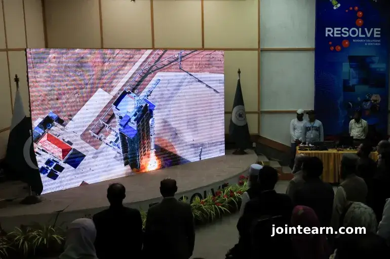
In a historic step for its national space program, Pakistan successfully launched its first-ever hyperspectral satellite, marking a transformative moment for the country’s technological and scientific advancement. The Pakistan Space and Upper Atmosphere Research Commission (SUPARCO) announced the successful deployment of the H1 satellite from China’s Jiuquan Satellite Launch Centre on October 19, 2025.
This landmark achievement is expected to dramatically enhance Pakistan’s capacity in environmental monitoring, precision agriculture, urban planning, and disaster management, positioning the country as an emerging player in space-based research and innovation.
A Technological Milestone for Pakistan’s Space Program
The launch of the H1 Hyperspectral Satellite represents a significant stride in Pakistan’s aerospace and data observation capabilities. Unlike conventional satellites, hyperspectral satellites can detect subtle variations in surface composition and chemical changes, providing scientists with precise insights into land, water, and atmospheric conditions.
According to SUPARCO, this advanced imaging capability will be instrumental in tracking agricultural productivity, monitoring deforestation, assessing water quality, and identifying environmental hazards before they escalate into large-scale disasters.
“The data from the Hyperspectral Satellite is poised to revolutionize agricultural productivity, bolster climate resilience, and enable optimized management of the country’s vital natural resources,” said SUPARCO Chairman Muhammad Yousuf Khan, speaking to Dawn newspaper.
Strengthening National Development and CPEC Integration
Pakistan’s Ministry of Foreign Affairs emphasized that H1’s launch aligns with the nation’s broader Vision 2047 development goals. The ministry said that hyperspectral imaging will play a crucial role in supporting the China-Pakistan Economic Corridor (CPEC) — a multi-billion-dollar initiative connecting China’s Xinjiang province to Pakistan’s Gwadar Port.
By offering enhanced geospatial data, the satellite will improve the planning and monitoring of infrastructure projects, while also enabling real-time detection of geohazard risks such as landslides, floods, and soil erosion.
“This mission is a pivotal step forward in Pakistan’s space journey and a reflection of its enduring partnership with China in the peaceful exploration of space,” the ministry stated.
A Symbol of Pak-China Space Cooperation
The H1 mission highlights the deep-rooted collaboration between Pakistan and China in advancing peaceful uses of outer space. For decades, China has assisted Pakistan in developing space technology, training personnel, and launching satellites.
This cooperation underscores both countries’ strategic goal of leveraging space science for socioeconomic progress. The Foreign Ministry described the launch as a symbol of “the ever-growing strategic partnership and friendship between the two nations.”
Expanding Pakistan’s Satellite Fleet
The H1 Hyperspectral Satellite joins two other satellites launched earlier this year — the EO-1 (Electro-Optical Satellite) and KS-1 (Communication Satellite) — both of which are currently fully operational in orbit.
The addition of H1 expands Pakistan’s remote-sensing infrastructure, giving researchers and policymakers access to high-resolution imagery and multi-spectral data critical for environmental conservation and scientific studies.
SUPARCO officials have confirmed that it will take approximately two months to calibrate H1’s systems before it becomes fully functional by the end of 2025. Once operational, the satellite will transmit data to ground stations in Karachi and Islamabad, supporting national and regional development initiatives.
Advancing Research, Climate Action, and Disaster Resilience
Experts believe the new satellite will revolutionize Pakistan’s climate and environmental research. By offering detailed hyperspectral imagery, the satellite can detect soil degradation, water pollution, and crop stress with remarkable precision.
These capabilities are expected to help improve food security, manage natural resources sustainably, and strengthen the country’s disaster management framework — particularly vital for a nation frequently affected by floods, droughts, and earthquakes.
Environmental scientists have hailed the launch as a “quantum leap” for Pakistan’s data-driven policy-making and global climate resilience efforts.
Looking Toward the Future
With three active satellites now orbiting Earth, Pakistan’s space ambitions are accelerating rapidly. SUPARCO’s long-term roadmap includes expanding partnerships with international research organizations, developing indigenous satellite technology, and investing in space education and training for the next generation of scientists.
The successful launch of the H1 satellite demonstrates Pakistan’s growing self-reliance in space exploration and its commitment to harnessing cutting-edge technology for sustainable growth, innovation, and national progress.


Leave a Reply