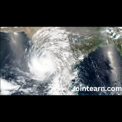
The India Meteorological Department (IMD) has issued a warning about a severe cyclonic storm expected to make landfall along the Andhra Pradesh coast on the night of Tuesday, October 28, 2025. According to the IMD, the cyclone is likely to cross the coastline between Machilipatnam and Kalingapatnam, near Kakinada, bringing heavy to very heavy rainfall across Andhra Pradesh and affecting neighbouring states including Odisha and West Bengal. Authorities have been advised to prepare for potential flooding, strong winds, and disruptions in normal life.
The system over the Bay of Bengal began as a well-marked low-pressure area over the southeast Bay of Bengal. It moved westwards and intensified into a depression, currently located about 990 kilometres southeast of Visakhapatnam, 990 kilometres east-southeast of Chennai, 1000 kilometres southeast of Kakinada, and 1040 kilometres south-southeast of Gopalpur in Odisha. The IMD forecasts that the depression will move in a west-northwestward direction, strengthening into a deep depression by October 26 and further intensifying into a cyclonic storm over the southwest and adjoining west-central Bay of Bengal by the morning of October 27.
As the storm continues to intensify, it is expected to reach severe cyclonic storm status by the morning of October 28, with maximum sustained wind speeds of 90–100 kmph, gusting up to 110 kmph. The cyclone is predicted to make landfall later that evening or night along the Andhra Pradesh coast. Such wind speeds can cause significant damage to infrastructure, uproot trees, disrupt communication lines, and trigger coastal flooding. The IMD has therefore urged authorities, residents, and maritime operators to take precautionary measures.
Alongside the Bay of Bengal system, a depression is developing over the east-central Arabian Sea. This system, currently centred about 380 kilometres west-northwest of Panjim (Goa), 400 kilometres southwest of Mumbai, 620 kilometres northwest of Mangalore, and 640 kilometres north-northwest of Aminidivi in Lakshadweep, is expected to move northwestward across the Arabian Sea over the next 24 hours. Heavy rains are forecast for coastal and adjoining regions of Goa, Konkan, Gujarat, and Kerala due to this system, although it is not expected to intensify into a severe cyclone like the Bay of Bengal system.
The IMD bulletin emphasizes that the combined effect of these weather systems could lead to localized flooding, waterlogging, and disruption in transportation. Coastal residents, fishermen, and shipping operators have been specifically advised to exercise caution and adhere to official advisories. Early warning systems and evacuations, if necessary, are expected to be activated in vulnerable areas along the Andhra Pradesh coast.
Historical patterns indicate that cyclones forming over the Bay of Bengal during this time of year can intensify rapidly due to warm sea surface temperatures and conducive atmospheric conditions. The IMD has maintained continuous surveillance of the system and will provide regular updates on its trajectory, intensity, and potential impacts. The public is advised to monitor official channels and avoid venturing into coastal waters until the cyclone passes.
With the festive season underway and large populations in the coastal belt, disaster management authorities are likely to mobilize relief and precautionary measures, including evacuation of low-lying areas, temporary shelter arrangements, and stockpiling of essential supplies. The Andhra Pradesh government has already alerted district authorities to prepare for heavy rainfall and strong winds that could disrupt power supply, communications, and transportation networks.
Meteorologists have pointed out that cyclones of this nature often bring extensive rainfall not only to the immediate coastal regions but also to interior areas as they move inland, potentially affecting agriculture, road transport, and daily life. Given the predicted intensity of the storm, precautionary measures are essential to minimize loss of life and property.
Residents in the affected regions are advised to secure loose structures, avoid unnecessary travel, and stay updated with weather alerts. Schools and offices in vulnerable districts may see temporary closures depending on the progression of the storm, while transport services—especially maritime, rail, and road—may be disrupted in the days surrounding the cyclone’s landfall.
In summary, India faces two developing weather systems, with the more severe cyclone expected to strike Andhra Pradesh between Machilipatnam and Kalingapatnam on the evening of October 28. Heavy to very heavy rainfall is forecast over Andhra Pradesh, Odisha, and West Bengal, accompanied by strong winds and potential flooding. The IMD has urged residents, authorities, and maritime operators to remain vigilant and follow all safety advisories, as precautionary measures will be crucial in minimizing the storm’s impact.


Leave a Reply